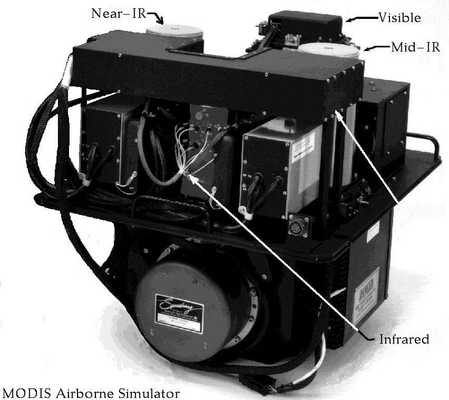
The MODIS Airborne Simulator (MAS) is an airborne multispectral spectrometer that simulates the Moderate-Resolution Imaging Spectrometer (MODIS) satellite instrument. MAS operates over 50 spectral channels spanning 0.55 to 14.2 μm, producing high-resolution images of clouds and surface features. It has a horizontal spatial resolution of 50 meters and a swath width of about 36 kilometers at an altitude of 20 km at nadir. Its scan rate is 6.25 Hz, with each scan line containing 716 pixels.


Instrument Details
- Spectrometer/Radiometer
- Earth Science > Atmosphere > Atmospheric RadiationEarth Science > Spectral/engineering > Visible Wavelengths > Visible ImageryEarth Science > Spectral/engineering > Infrared Wavelengths > Infrared ImageryEarth Science > Spectral/engineering > Visible Wavelengths > Visible RadianceEarth Science > Spectral/engineering > Infrared Wavelengths > Infrared Radiance
- Lower Stratosphere, Troposphere
- 6.25 Hz
- 50 m
- 21-545 THz
- https://doi.org/10.1117/12.258115
James D. Jacobson Jr., Thomas Ellis, Steve Platnick
James D. Jacobson Jr.
Dædalus Enterprises, Inc
MODIS Science Team, EOS Project Science Office, NASA Radiation Science Program
Currently unavailable
Filter data products from this instrument by specific campaigns, platforms, or formats.


