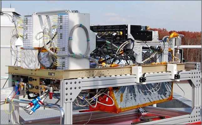
The Multiple Altimeter Beam Experimental Lidar (MABEL) is an airborne lidar system designed as a testbed for the Advanced Topographic Laser Altimeter System (ATLAS) on ICESat-2. It measures lidar backscatter at 532 and 1064 nm to determine the properties of ice, snow, water, and clouds. MABEL has a swath width of up to 1.05 km and a pulse repetition rate of 5 to 25 kHz.


Instrument Details
- Lidar
- Earth Science > Spectral/engineering > Lidar > Lidar BackscatterEarth Science > Spectral/engineering > Lidar
- Full Column Profile
- Variable
- Swath Width: +/- 1.05 km
- 563.5 THz, 281.8 THz
- Currently unavailable
Currently unavailable
Currently unavailable
NASA
NASA
Unpublished
 NASA Earth Resources-2 Aircraft 64 Campaigns · 110 Instruments | MABEL Multiple Altimeter Beam Experimental Lidar 2010—2014 Western United States, Mid-Atlantic, Alaska, Greenland, Iceland 7 Deployments · 0 Data Products
| ||||||||||||||||
 Scaled Composites Proteus 4 Campaigns · 8 Instruments | MABEL Multiple Altimeter Beam Experimental Lidar 2010—2014 Western United States, Mid-Atlantic, Alaska, Greenland, Iceland 7 Deployments · 0 Data Products
|