The Land, Vegetation, and Ice Sensor (LVIS) is an airborne imaging lidar developed and operated by Goddard Space Flight Center (GSFC). It creates topographic maps and examines the vertical structure of vegetation and ice. It operates at a wavelength of 1064 nm and supports pulse repetition rates up to 500 Hz. LVIS has a swath width of 2 km and a horizontal resolution of 20 m at a flight altitude of 10 km.
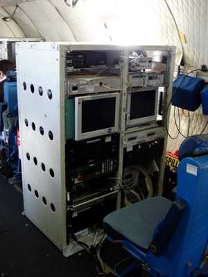

Instrument Details
- Lidar
- Earth Science > Land Surface > TopographyEarth Science > Biosphere > VegetationEarth Science > Climate Indicators > Cryospheric Indicators > Sea Ice ElevationEarth Science > Land Surface > Topography > Terrain ElevationEarth Science > Biosphere > Vegetation > Canopy CharacteristicsEarth Science > Terrestrial Hydrosphere > Glaciers/ice Sheets > Glacier Elevation/ice Sheet Elevation
- Land Surface
- Variable
- 20 m
- 282 THz
- Currently unavailable
J. Bryan Blair
J. Bryan Blair
GSFC
NASA
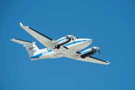 Beechcraft B-200 King Air 39 Campaigns · 84 Instruments | AfriSAR AfriSAR 2015—2016 Gabon tropical forests 1 Deployment · 10 Data Products
 Operation IceBridge 2009—2021 Greenland, Antarctica, Alaska, Arctic Sea 37 Deployments · 79 Data Products
 Arctic-Boreal Vulnerability Experiment 2017—2026 Alaska, Northwestern Canada Ongoing 6 Deployments · 130 Data Products
 Costa Rica Airborne Research and Technology Applications 2005 2005 San Jose, Costa Rica 1 Deployment · 0 Data Products
| ||||||||||||||||||||||||||||||||||||||||||||||||||||||||||||||||||||||||||||||||||||||||||||||||||
 Gulfstream-V 10 Campaigns · 47 Instruments |  Arctic-Boreal Vulnerability Experiment 2017—2026 Alaska, Northwestern Canada Ongoing 6 Deployments · 130 Data Products
 Operation IceBridge 2009—2021 Greenland, Antarctica, Alaska, Arctic Sea 37 Deployments · 79 Data Products
 Biodiversity Survey of the Cape 2023 South Africa’s Greater Cape Floristic Region (GCFR) 1 Deployment · 5 Data Products
ICESat-2 Summer Sea Ice Cal/Val ICESat-2 Summer Sea Ice Cal/Val 2022 Northwestern Greenland, Arctic Ocean 1 Deployment · 0 Data Products
| ||||||||||||||||||||||||||||||||||||||||||||||||||||||||||||||||||||||||||||||||||||||||||||||||||
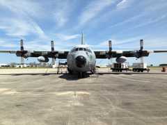 C-130 Hercules 17 Campaigns · 96 Instruments |  Arctic Radiation - IceBridge Sea and Ice Experiment 2014 Alaska, Beaufort Sea 1 Deployment · 5 Data Products
 Operation IceBridge 2009—2021 Greenland, Antarctica, Alaska, Arctic Sea 37 Deployments · 79 Data Products
| ||||||||||||||||||||||||||||||||||||||||||||||||||||||||||||||||||||||||||||||||||||||||||||||||||
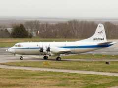 P-3 Orion 30 Campaigns · 153 Instruments |  Operation IceBridge 2009—2021 Greenland, Antarctica, Alaska, Arctic Sea 37 Deployments · 79 Data Products
 Arctic Radiation-Cloud-Aerosol-Surface Interaction EXperiment 2024 Greenland, Arctic Ocean 2 Deployments · 13 Data Products
| ||||||||||||||||||||||||||||||||||||||||||||||||||||||||||||||||||||||||||||||||||||||||||||||||||
 Douglas DC-8 46 Campaigns · 184 Instruments |  Operation IceBridge 2009—2021 Greenland, Antarctica, Alaska, Arctic Sea 37 Deployments · 79 Data Products
| ||||||||||||||||||||||||||||||||||||||||||||||||||||||||||||||||||||||||||||||||||||||||||||||||||
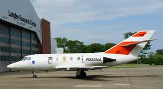 HU-25 Guardian 2 Campaigns · 8 Instruments |  Operation IceBridge 2009—2021 Greenland, Antarctica, Alaska, Arctic Sea 37 Deployments · 79 Data Products
|
Filter data products from this instrument by specific campaigns, platforms, or formats.