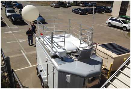
The Langley Mobile Ozone Lidar (LMOL) is a mobile, ground-based lidar developed at NASA Langley Research Center (LaRC). It is a differential absorption lidar that measures ozone, aerosols, and clouds. It operates at 287 nm and 292 nm for ozone retrievals and at 527 nm for aerosol detection. It has a pulse width of 70 ns and a range resolution of 7.5 m. LMOL is part of the Tropospheric Ozone Lidar Network (TOLNet), which is operated by NASA.


Instrument Details
- Lidar
- Earth Science > Atmosphere > Air Quality > Tropospheric OzoneEarth Science > Atmosphere > Atmospheric Chemistry > Oxygen Compounds > Ozone
- Full Column Profile
- N/A
- 7.5 m
- 569 THz, 1027 THz, 1045 THz
- Currently unavailable
Tim Berkoff
John Hair
NASA
NASA Earth Sciences Division
Filter data products from this instrument by specific campaigns, platforms, or formats.
CAMPAIGNS
PLATFORMS


