The Compact Airborne Spectrographic Imager (CASI) is an airborne push-broom imaging spectrometer developed by Itres Research Ltd. CASI measures reflectance in the visible/near-infrared (VNIR) spectral region, enabling derivation of vegetation characteristics. It operates in the 430-870 nm range and has a 35-degree field of view (FOV). CASI has a cross-track ground resolution of 1.23 meters at 1 km altitude above ground level (AGL). The along-track resolution depends on integration time and aircraft speed. CASI has a frame rate of 85 lines per second.

Instrument Details
- Spectrometer/Radiometer
- Earth Science > Biosphere > Vegetation > Vegetation Index > Leaf Area Index (lai)Earth Science > Biosphere > Vegetation > Canopy CharacteristicsEarth Science > Biosphere > VegetationEarth Science > Land Surface > Surface Radiative PropertiesEarth Science > Land Surface > Surface Radiative Properties > Reflectance
- Land Surface, Troposphere
- 85 frames/sec
- 1.23 m per 1 km altitude AGL
- 345-698 THz
- https://doi.org/10.1080/07038992.1992.10855328
Stephen K. Babey
C.D. Anger, Raymond J. Soffer
Itres Research Ltd
Defence Research Establishment, Suffield, Chief Research & Development, Department of National Defence, Canada
Currently unavailable
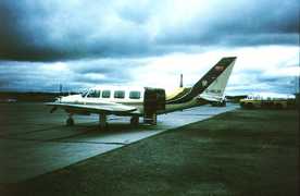
 Piper Navajo Chieftain 3 Campaigns · 5 Instruments |  Boreal Ecosystem-Atmosphere Study 1994—1996 Boreal forests of central Canada 2 Deployments · 303 Data Products
| ||||||||||
PA-23 Piper PA-23 1 Campaign · 2 Instruments | OTTER Oregon Transect Ecosystem Research Project 1989—1991 western coniferous forest in Oregon 3 Deployments · 14 Data Products
| ||||||||||
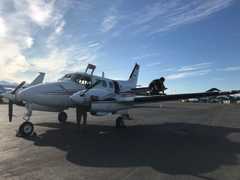
 Beechcraft King Air A90 3 Campaigns · 6 Instruments |  SnowEx 2016—2023 Colorado, Idaho, Utah, Alaska 4 Deployments · 86 Data Products
|
Filter data products from this instrument by specific campaigns, platforms, or formats.